Catalog excerpts

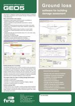
Ground loss There are many programs designed to determine surface ground settlement induced by tunnel excavation. However very few of them are capable of predicting the impact of the surface deformations on buildings located in the affected zone and allowing engineers to design such static arrangements to sufficiently prevent the objects from negative effects of excavationand also helping to estimate additional costs due to their damage. Let us introduce a new program based on damage risk evaluation of ground structures situated at the settlement trough area, comprehending designing standard used in the European Union and North America. Calculations are supported by practical engineering experiences gained during constructions of many road, railway and underground tunnels in soft grounds and clays in Prague, Brno and Budapest. The author, Radko Bucek MSc., Ph.D., is a distinguished expert in the field of underground structures. He gained his abundant experiences while collaborating with world-known consultant companies such as Golder Associates, SG-Geotechnika, D2-Consult. Recently he works as the Chief Tunnel Engineer in Mott MacDonald Prague. Assessment of risk of building damage due to tunnelling Development of software Ground Loss and its practical use: The initial impulse to develop a program allowing engineers to instantly evaluate trend of surface deformations and their effects on existing buildings came during construction of twin-tube highway tunnel Mrazovka in Prague in 2001. The core of the program is based on information assumed from national designing standards and available technical literature. Then database of relationships between shape of the subsidence trough and its effects on damage of the buildings was implemented to the program along with evaluation criterions of damage classification of multi-storey masonry buildings located above shallow bored tunnels. Authors of the program collected important data on properties of subsidence troughs in various geological environments includingclay slates, quartzite and overconsolidated clays. Next step in development of the program was its generalization for Sequential Excavation Method (New Austrian Tunnelling Method) and interaction among more tunnels. The program was used during constructionof Prague underground line IV C2 and large single-nave undergroundstation Kobylisy to predict settlement magnitude with accuracy ofmillimetres and to determine damage of affected buildings including prediction of main cracks location together with their static consequences. In cooperation with company Fine, developer of civil engineering software, the original program has been considerably improved and implemented into professional geotechnical software package GEO5. References: The software was used by Austrian company D2-Consult during construction of underground line “Budapest metro line 4” in Budapest to predict ground settlement and its effects on surrounding buildings. Since 2005 the program has been continuously used by company Ko-ka for designing collectors in Prague. Recently the software has been used by company Mott MacDonald, Prague. The author of the program works there as the chief engineer in branch of underground structures.
Open the catalog to page 1
Ground loss The program is designed to analyze and determine shape of subsidence trough above excavations and to evaluate damage of buildings situated in the affected area. software for building damage assesment Basic characteristics of the program: • Subsidence trough analysis using the Volume Loss Method or classical theories (Peck, Limanov, Fazekas) • Shape of subsidence trough estimated using Gauss or Aversin approximation • Possibility to model sequential excavation and multiple tunnel tubes • Determination of subsidence trough shape, settlement, gradient and horizontal strains •...
Open the catalog to page 2All FINE catalogs and technical brochures
-
Pile
18 Pages
-
Pile CPT
12 Pages
-
FIN EC Edition 2017
826 Pages
-
Settlement
11 Pages
-
Gravity wall
10 Pages
-
GEO5 leaflet
2 Pages


