- Catalogs
- BENTLEY SYSTEMS
- Bentley Descartes V8i
Bentley Descartes V8i

Bentley Descartes V8i
- Advanced Point Cloud Processing: Enhances productivity by allowing reclassification, filtering, and extraction of geometry from point clouds for accurate engineering models.
- Image Mosaics: Facilitates the creation of seamless mosaics from multiple images, maintaining high performance and transportability.
- Rapid Interpretation and Conversion: Offers robust tools for image editing and raster-to-vector conversion, including cleanup, vectorization, and Optical Character Recognition.
- On-the-Fly Projection: Transforms georeferenced images to different coordinate systems instantly, with batch processing capabilities.
- Precision Registration: Provides intuitive WYSIWYG image registration, allowing dynamic warping and transformation verification before resampling.
- Support for Industry Formats: Supports a wide range of image formats natively, ensuring optimal performance and easy conversion.
- Flexible Image Manipulation: Includes tools for cropping, scaling, and enhancing images, facilitating the production of montages and document layouts.
- Scalable Terrain Modeling: Enables the use of large terrain models for city or regional planning, with various display modes and synchronization capabilities.
Catalog excerpts
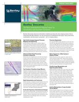
>.--^fl Sustaining Infrastructure PRODUCT DATA SHEET The Most Comprehensive Imaging Product for Visualization and Document Conversion Bentley Descartes advances information modeling by being the only imaging productthat is integrated with MicroStation® for the processing of fundamental data types, high productivity visualization, and document conversion - all in a single product. M/ort M//f/? multiple images as if they are Visualize and edit point cloud data. Combine various formats in a single scene. High-fidelity Imaging Supports Precision Bentley Descartes enables users to combine imagery in virtually any format and projection with the precision map- ping capabilities of MicroStation and Bentley's geospatial applications for map production and digital map creation to support business or government requirements. The seamless integration of Bentley Descartes with MicroStation avoids dual working environments for raster and vector information. Advanced Point Cloud Processing Increases Productivity Bentley Descartes integrates point cloud data with engineer- ing tools. Users can easily reclassify point cloud data to fix classification errors, filter point cloud to isolate key points, drape vectors along an arbitrary direction, extract geom- etry for hybrid point cloud-vector models, and more. These capabilities enable users to better evaluate point clouds and produce more accurate engineering models, for civil, building, plant, and geospatial projects. Fast Creation of Seamless Image Mosaics Capitalize on the high performance display engine and the capabilities of Bentley Descartes to create seamless mosaics of multiple images, scanned aerial photos, or adjacent raster scanned images to see the complete picture. Users can choose to leave the source images in their original form to produce a mosaic or create an easily transportable mosaic all in one file. Rapid Interpretation and Conversion Bentley Descartes is designed to provide fingertip control over all the editing functions necessary for image interpretation and raster-to-vector conversion. It expedites work, saving time and money with a robust set of tools including cleanup, vectorization, and Optical Character Recognition. On-the-fly Projection of Georeferenced Images When used with Bentley Map®, any georeferenced image can be transformed on-the-fly to another coordinate system and projection. Dynamic resampling provides instantaneous raster transformation and Job Manager allows users to process resampling jobs in batch. Precision Registration Our unique WYSIWYG image registration is much more intui- tive than other approaches that require distinct windows for vector and image data and that rely heavily upon transforma- tional statistics. Registration provides for dynamic warping that overlays vector data over the uncorrected image to enable users to verify the transformation model before resam- pling the image, and for transformation of vector data through the same model and batch resampling of images. Native Support for a Wide Variety of Industry Formats Bentley Descartes provides support for a wide variety of industry-standard image formats. Native binary, grayscale, and color image formats (1, 4, 8,11 and 24,48 and 64-bits). All formats are implemented natively for optimal performance. Fast open and save operations without conversion are supported and files can easily be converted to any supported format. Flexible Image Manipulation and Rapid Document Editing Bentley Descartes includes tools to crop, copy, move, merge, scale, mirror, square, and rotate images or objects within images, as well as tools to make regions of images trans- lucent or transparent. Use these capabilities to automate production of montages, corridor and plan sheet alignments, or to lay out plots or documents. Clean up drawings by filling holes, using erasers, despeckling, and a variety of other methods. Bentley Descartes also provides a rich set of tools to edit images. Rapidly improve the quality of poor source drawings in order to take advantage of automated conver- sion tools or quickly restore and enhance legacy drawings to prolong their life. Intuitive Manipulation of Large Scalable Terrain Models Bentley Descartes enables the use and display of very large terrain models, typically for city or regional level planning, increasing the return on investment on large datasets. Users can display the scalable terrain model (STM) in a variety of modes and can easily keep it up to date by synchronizing it with a wide variety of sources.
Open the catalog to page 1
System Requirements Please refer to the Installation Requirements section of the Bentley Descartes ReadMe file at www.bentley.com/Descartes-Spec Find out about Bentley at: www.bentley.com Contact Bentley 1-800-BENTLEY (1-800-236-8539) Outside the US +1 610-458-5000 Global Office Listings www.bentley.com/contact Bentley Descartes At-A-Glance Visualization • Image draping on DTM or 3D Objects • MicroStation-based rendering • Real-life textures • Lighting effects • Elevation • Perspective • Creation of fly-throughs and animations • Creation of 3D PDFs • Interpretation and Conversion • Semi-automatic...
Open the catalog to page 2All BENTLEY SYSTEMS catalogs and technical brochures
 GenerativeComponents®
2 Pages
 AECOsim Building Designer
8 Pages
 InspectTech
2 Pages
 Product Family Brochure
4 Pages
 Bentley Facilities V8i
2 Pages
 Bentley Data Manager V8i
2 Pages
 Bentley Copper V8i
2 Pages
 Bentley MXROAD V8i
2 Pages
 Bentley AutoPIPE Vessel V8i
2 Pages
 Bentley AutoPIPE V8i
2 Pages
 Bentley AutoPIPE Nozzle
2 Pages
 AutoPLANT Isometrics V8i
2 Pages
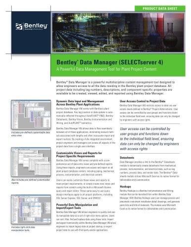 Bentley ® Data Manager
2 Pages
 Bentley AXSYS.Process
2 Pages
 AutoPLANT ® Piping V8 i
2 Pages
 AutoPLANT ® Isometrics V8 i
2 Pages
 ProjectWise Fact Sheet
2 Pages
 ProjectWise 2011
8 Pages
 New in V8i (SELECTseries 3)
77 Pages
 MicroStation Brochure
8 Pages
 Power rail track
4 Pages
 LarS Bridge ?
2 Pages


Archived catalogs
 STAAD.Pro
2 Pages
 Bentley Microstation
2 Pages
 Bentley PowerDraft
2 Pages
 Bentley ARCHITECTURE
2 Pages
- Design software
- 3D software
- Industrial management software
- Concrete structure software
- Analysis software
- Steel structure software
- 2D software
- Industrial calculation software
- Architecture software
- Industrial monitoring software
- Smartphone software
- Modeling software
- Drawing software
- Building automation system software
- Wooden structure software
- Real-time software
- Autocad software
- Electrical installation software
- Construction management software
- Lighting management software