


Infrastructure Design Suite 2013

Infrastructure Design Suite 2013
- Inconsistent and uncoordinated information leading to increased risks and costs.
- Challenges in evaluating existing conditions due to data fragmentation.
- Difficulties in applying consistent engineering standards.
- Inefficient information sharing causing time loss and duplication.
- Underutilization of model-based design benefits like visualization and simulation.
- Challenges in stakeholder communication and project approval.
- Increased project costs due to late discovery of design problems.
- Standard Edition: Provides foundational GIS and design capabilities with AutoCAD workflow, integrated CAD and GIS functionality, and tools for data organization and coordination.
- Premium Edition: Enhances BIM implementation with intelligent model-based design tools, integrated analysis, and visualization capabilities for civil infrastructure.
- Ultimate Edition: Offers advanced capabilities for utility network design, structural engineering, and construction coordination, including specialized tools for electrical distribution and civil structures.
- Integration of multiple data types for comprehensive project views.
- Visualization of design ideas in real-world contexts.
- Integrated analysis for better project outcome predictions.
- Customizable engineering standards for improved design consistency.
- Enhanced design productivity with synchronous design and drafting.
- Creation of compelling visuals for effective communication of design intent.
- Improved constructability, cost, and schedule visibility.
Catalog excerpts

Autodesk Infrastructure Design Suite 2013 ® Visualize success with Autodesk BIM for Infrastructure. Rendering of an urban site showcasing transportation, utility, land, and water infrastructure. Autodesk® Infrastructure Design Suite products, including Autodesk® 3ds Max® Design software, were used in the design process.
Open the catalog to page 1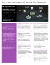
Plan. Design. Build. Manage. All with BIM for Infrastructure • Plan — Access and integrate CAD and GIS data for analysis and more informed decision making • Design & Document — Explore more design options, analyze project performance, and deliver more coordinated documentation • Validate & Visualize — Create renderings and animation to help validate designs, communicate design intent and create compelling presentations • Coordinate — Integrate models from multiple sources for project review and construction sequencing • Manage — Maintain infrastructure information more dependably with intelligent...
Open the catalog to page 2
Model-based design, analysis, visualization, and simulation Autodesk Infrastructure Design Suite offers a comprehensive software solution for planning, designing, building, and managing civil and utility infrastructure. AutoCAD® software provides powerful design and documentation tools, extensive customization options, and native DWG support. Autodesk® 3ds Max® Design software helps you automate the creation of cinematic-quality visuals and animations from civil data to evaluate designs and support the communication of project intent. AutoCAD® Map 3D software is a model-based infrastructure planning...
Open the catalog to page 3
Moving to Autodesk Infrastructure Design Suite allows us to offer a wider range of services to our clients. We can now deliver project visualizations and simulations in addition to Civil 3D models and engineering drawings. — Matthew Dalton CAD/GIS Consultant SRK Consulting Limited Learn More or Purchase Access specialists worldwide who can provide product expertise, a deep understanding of your industry, and value that extends beyond your software. To license Autodesk Infrastructure Design Suite software, contact an Autodesk Authorized Reseller. Locate an Autodesk Reseller near you at www.autodesk.com/reseller....
Open the catalog to page 4All Autodesk catalogs and technical brochures
 Autodesk ® Television
7 Pages
 Autodesk ® Games
7 Pages
 Autodesk ® Film
7 Pages
 Revit Architectural Design
4 Pages
 AutoCAD MEP 2013 brochure
4 Pages
 AutoCAD LT 2013 brochure
2 Pages
 Product Design Suite
4 Pages
 Plant Design Suite
8 Pages
 Factory Design Suite
4 Pages
 Design and build
4 Pages


Archived catalogs
 Plant Design Suite
6 Pages
 AutoCAD® CIVIL 3D
6 Pages
 AutoCAD® 2011 overview
4 Pages
 AutoCAD® Architecture 2011
4 Pages


- Autodesk management software
- Autodesk analysis software
- Autodesk concrete structure software
- Autodesk steel structure software
- Autodesk 2D software
- Industrial calculation software
- Autodesk Windows software
- Autodesk smart software
- Autodesk tablet computer software
- Industrial monitoring software
- Autodesk architecture software
- Autodesk cloud software
- Smartphone software
- Autodesk modeling software
- Autodesk building automation system software
- Drawing software
- Autodesk control software
- Autodesk data management software